World · Greenbelt, Maryland · Elections hub
NASA satellites map how farming and dams are reshaping Earth's water
In brief
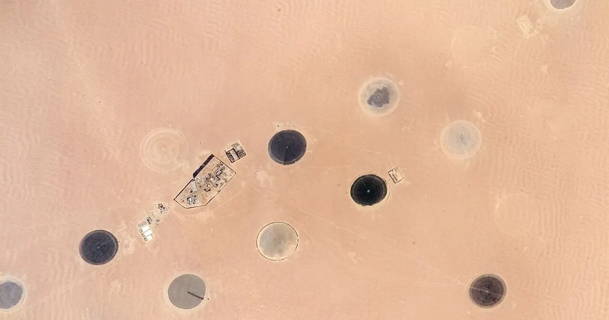
A new NASA-led study used more than two decades of gravity measurements from the GRACE and GRACE-FO satellites to map where people are changing how much water is stored on land. The researchers found 40 regions where water storage trends from April 2002 to November 2025 lined up with human activities such as irrigation, reservoir filling and land-use change.
Weighing water from space
GRACE and its follow-on mission each use two satellites flying one behind the other. When the lead satellite passes over a place with more mass, the tiny change in gravity tugs on it, and instruments measure the change in distance between the pair. Because water is heavy and moves around, scientists can use those readings to estimate where water is gained or lost. By combining more than 20 years of passes, the team mapped long-term trends with five to 10 times more detail than earlier studies, according to NASA Earth Observatory.
Where water is going
Farmland watered by groundwater was strongly linked to falling water storage in places like California's Central Valley, the southern High Plains of the U.S., Chihuahua in Mexico and northern India. In India, the refined analysis showed a steeper decline than earlier estimates suggested, and retreating Himalayan glaciers explained only about 15% of the loss there. Some changes went the other way: parts of sub-Saharan Africa and Brazil's Maranhão state gained water where rainfed cropland replaced natural vegetation.
The sharper map also picked out engineering projects, including the Boguchany Reservoir on Russia's Angara River and water seeping from the Karakum Canal in Turkmenistan's desert. Human activities were significantly linked to storage trends on every nonpolar continent except Australia. The study, led by NASA Goddard hydrologist Mary Michael O'Neill, was published in the Proceedings of the National Academy of Sciences.
VSH take: the striking part is not that groundwater is falling, which farmers in Punjab and California already know, but that satellites can now see it region by region from orbit. That makes it easier to check whether new water policies actually work. Explore more satellite views on our Live Earth and Space tools, and see how places have changed over time on Earth Then and Now.
This is our own summary of NASA's published findings. ViralScopeHub is not affiliated with NASA.
Why it matters
Groundwater supplies drinking water and irrigation for hundreds of millions of people, so knowing exactly where it is being drawn down helps governments and farmers plan.
People also ask
What did the NASA GRACE study find?
It identified 40 regions where long-term changes in land water storage from 2002 to 2025 matched human activities such as groundwater irrigation, reservoir filling and land-use change.
Why does northern India stand out?
Heavy groundwater pumping for farming has drawn down water storage there faster than earlier estimates suggested, and melting Himalayan glaciers explain only about 15% of the decline.
How do satellites measure groundwater?
GRACE satellites detect tiny changes in Earth's gravity caused by shifting water mass, which scientists convert into estimates of water gained or lost.
Related free tools: Percentage Calculator
Sources
Every ViralScopeHub news item is an original summary written in our own words. We link to the original reporting so you can read the full story from the publisher.