World · Pasadena, Calif. · Elections hub
NASA model: Thwaites Glacier could add more to sea level rise than thought
In brief
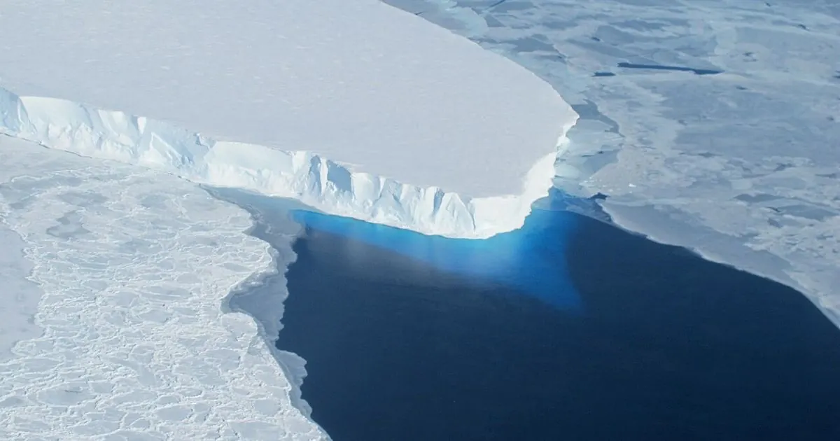
A new study using a computer model developed by NASA's Jet Propulsion Laboratory, the University of California, Irvine, and Dartmouth College suggests Antarctica's Thwaites Glacier could add more to sea level rise by 2100 than some earlier estimates. In some simulations its contribution was as much as twice current projections, NASA said on October 20, 2026.
Zones, not lines
The key change is how the model treats the place where the glacier stops resting on the seabed and starts to float. Most ice sheet models draw this as a sharp boundary called the grounding line. The new model treats it as a grounding zone: an area where seawater pushes several miles under the grounded ice, and tides lift and drop the ice. That brings warmer water into contact with ice that is still sitting on the bed, speeding up melting and making the glacier less stable than a simple line would allow. The study was published on October 12 in Nature Communications.
The researchers tested the model against the past. It matched satellite records of the glacier's retreat going back to the 1990s about four times more closely than models without grounding zones, which is why they think its projections are more reliable.
Why Thwaites gets so much attention
Thwaites, in West Antarctica, is the widest glacier on Earth, at about 120 kilometres across, and its basin covers about 192,000 square kilometres, larger than Florida. The International Thwaites Glacier Collaboration says its ice loss already accounts for around 4 per cent of global sea level rise, and that if the whole glacier collapsed, which would take centuries, seas would rise about 65 centimetres. That is why better projections matter to coastal cities planning sea walls, drainage and new buildings.
VSH take: it is easy to read "twice as much" and panic, but this is a range from computer simulations, not a forecast that it will happen. The useful lesson is that the details at the edge of the ice matter a lot. Students can turn the numbers into something familiar with our unit converter (65 cm is about 25.6 inches), look at our planet with Live Earth from space, or read our explainer on ocean temperatures and El Niño.
This is our own summary of published research and an agency announcement. ViralScopeHub is not affiliated with NASA, JPL, UC Irvine, Dartmouth College or the ITGC.
Why it matters
Thwaites is one of the biggest uncertainties in sea level forecasts, and those forecasts guide how coastal cities spend billions on flood protection.
People also ask
What did the new Thwaites Glacier study find?
A model from NASA JPL, UC Irvine and Dartmouth found Thwaites could add more to sea level rise by 2100 than some estimates; in some runs, up to twice current projections.
What is a grounding zone?
It is the area where a glacier lifts off the seabed and begins to float. Seawater can push several miles under the grounded ice there, and tides move the ice up and down.
How much would sea level rise if Thwaites collapsed?
The International Thwaites Glacier Collaboration estimates about 65 cm (25 inches), though a full collapse would take centuries.
Related free tools: Unit Converter, Scientific Calculator
Sources
- NASA Science: NASA Study Refines Projections for Thwaites Glacier
- International Thwaites Glacier Collaboration: Thwaites Glacier facts
Every ViralScopeHub news item is an original summary written in our own words. We link to the original reporting so you can read the full story from the publisher.