What you are looking at
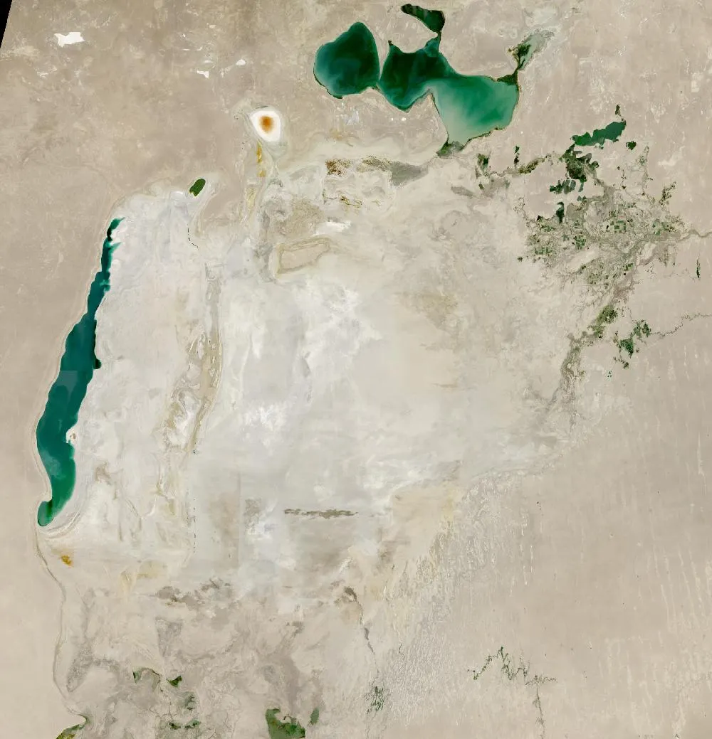
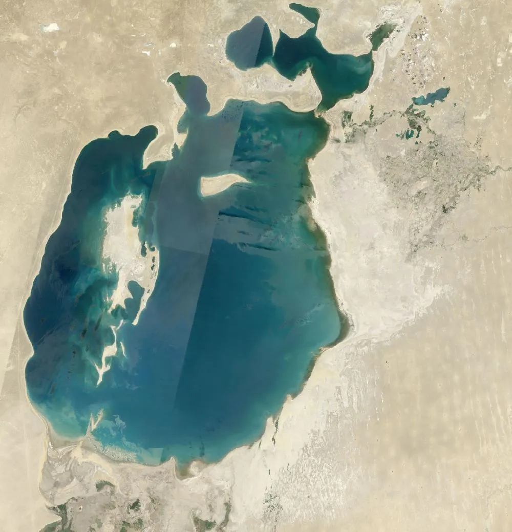
The left image is a 1985 Landsat composite of the Aral Sea on the border of Kazakhstan and Uzbekistan. It is already smaller than it was in 1960, but it is still one big body of water. The right image is recent. Most of the old sea bed is now pale desert, and only small parts of the lake are left: the North Aral Sea and a thin western basin of the South Aral Sea.
Why the sea shrank
In 1960 the Aral Sea covered about 68,000 square kilometres and was one of the four largest lakes on Earth. It is fed by two rivers, the Amu Darya and the Syr Darya. From the 1960s, Soviet planners diverted huge amounts of river water through canals to grow cotton and other crops in the desert. Less and less water reached the sea, and it began to shrink fast.
By the late 1980s it had split into a northern and a southern part. The water left behind became much saltier, and most native fish died out. Fishing towns such as Muynak and Aralsk were left far from the shore, with rusting boats stranded on dry land.
The new desert
The dried sea bed is now called the Aralkum Desert. Wind lifts salty dust from it and carries it over farms and towns. In 2014 satellites showed the eastern basin of the South Aral Sea completely dry for the first time in modern history.
A partial comeback
In 2005 Kazakhstan finished the Kokaral Dam, which keeps Syr Darya water in the North Aral Sea. Its level rose, the water became less salty and fish came back, along with some fishing jobs. Plans continue to improve it further. The large South Aral Sea, though, is unlikely to return.
Why it matters
The Aral Sea is often called one of the worst human-made environmental disasters. It shows how water taken from rivers upstream can change a whole region downstream. It is a good case study for geography lessons on water use.
For more years of change, explore Google Earth Timelapse (opens in a new tab), which shows Landsat images from 1984 to recent years for anywhere on Earth.
Frequently asked questions
Why did the Aral Sea dry up?
Most of the water from its two feeder rivers was diverted for farming from the 1960s, so far less water reached the sea than evaporated from it.
Is the Aral Sea coming back?
The North Aral Sea has partly recovered since the Kokaral Dam was finished in 2005. The South Aral Sea is still shrinking.
Where do these images come from?
Both images are from NASA and USGS Earth-observing satellites (Landsat and the joint NASA HLS product). They are free public-domain data, and we host copies on our site.
More Earth then and now
Data and credits: Satellite images: NASA/USGS Landsat via NASA GIBS (Global Web-Enabled Landsat Data, 1985 annual composite) and NASA Harmonized Landsat Sentinel-2 (HLS), 2025-08-05, Sentinel-2 (HLS S30). Public domain (NASA/USGS); HLS Sentinel-2 data includes modified Copernicus Sentinel data, free and open. Imagery accessed through NASA Worldview/GIBS. Text written by ViralScopeHub from NASA Earth Observatory, USGS and other public sources. See all Live Earth & Space tools and our credits page.