What you are looking at
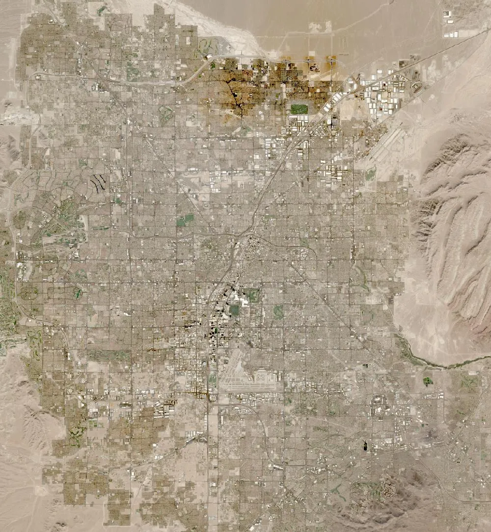
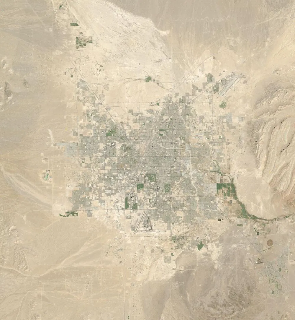
The left image is a 1985 Landsat composite of the Las Vegas Valley. The city sits near the middle with lots of bare desert around it. The right image is a recent view. Grey and green streets, homes and golf courses now fill most of the valley floor, right up to the mountains on the west and south.
One of the fastest-growing US cities
In 1980 the Las Vegas area had a little under half a million people. By 2020 Clark County, which holds the metro area, had about 2.3 million. Cheap land, jobs in tourism and building, and no state income tax brought new residents from across the country, especially in the 1990s and early 2000s.
New neighbourhoods like Summerlin in the west and Henderson in the south-east grew from empty desert into large suburbs. In the images you can see the regular grid of roads pushing outward and new green patches where parks and golf courses were watered.
Water in the desert
Las Vegas gets only about 10 cm of rain a year. Around 90% of its water comes from Lake Mead, the reservoir behind Hoover Dam on the Colorado River. As the city grew and drought hit the river, the region made strong water-saving rules. It paid people to replace grass lawns with desert plants, limited new ornamental grass and recycles almost all indoor water back to the lake. That is why the newest suburbs look browner than older ones. See our Lake Mead then and now page for the other half of the story.
Cities as heat islands
Roads and roofs soak up sunlight, so big cities stay warmer at night than the desert around them. This “urban heat island” is one reason city planners in Las Vegas now plant shade trees and use lighter roofing.
How to read the images
Bare desert looks tan or pink, city streets look grey, and watered grass looks bright green. The left image is a multi-year composite and the right is a single recent date, so tones differ slightly.
For more years of change, explore Google Earth Timelapse (opens in a new tab), which shows Landsat images from 1984 to recent years for anywhere on Earth.
Frequently asked questions
How much has Las Vegas grown?
The metro area grew from under half a million people in 1980 to about 2.3 million by 2020.
Where does Las Vegas get its water?
About 90% comes from Lake Mead on the Colorado River. The rest is mostly groundwater.
Where do these images come from?
Both images are from NASA and USGS Earth-observing satellites (Landsat and the joint NASA HLS product). They are free public-domain data, and we host copies on our site.
More Earth then and now
Data and credits: Satellite images: NASA/USGS Landsat via NASA GIBS (Global Web-Enabled Landsat Data, 1985 annual composite) and NASA Harmonized Landsat Sentinel-2 (HLS), 2024-10-21, Sentinel-2 (HLS S30). Public domain (NASA/USGS); HLS Sentinel-2 data includes modified Copernicus Sentinel data, free and open. Imagery accessed through NASA Worldview/GIBS. Text written by ViralScopeHub from NASA Earth Observatory, USGS and other public sources. See all Live Earth & Space tools and our credits page.