What you are looking at
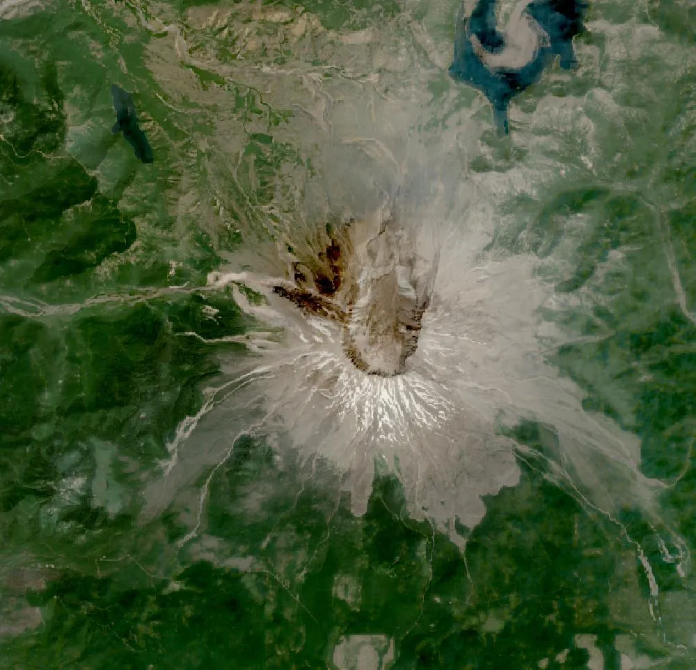
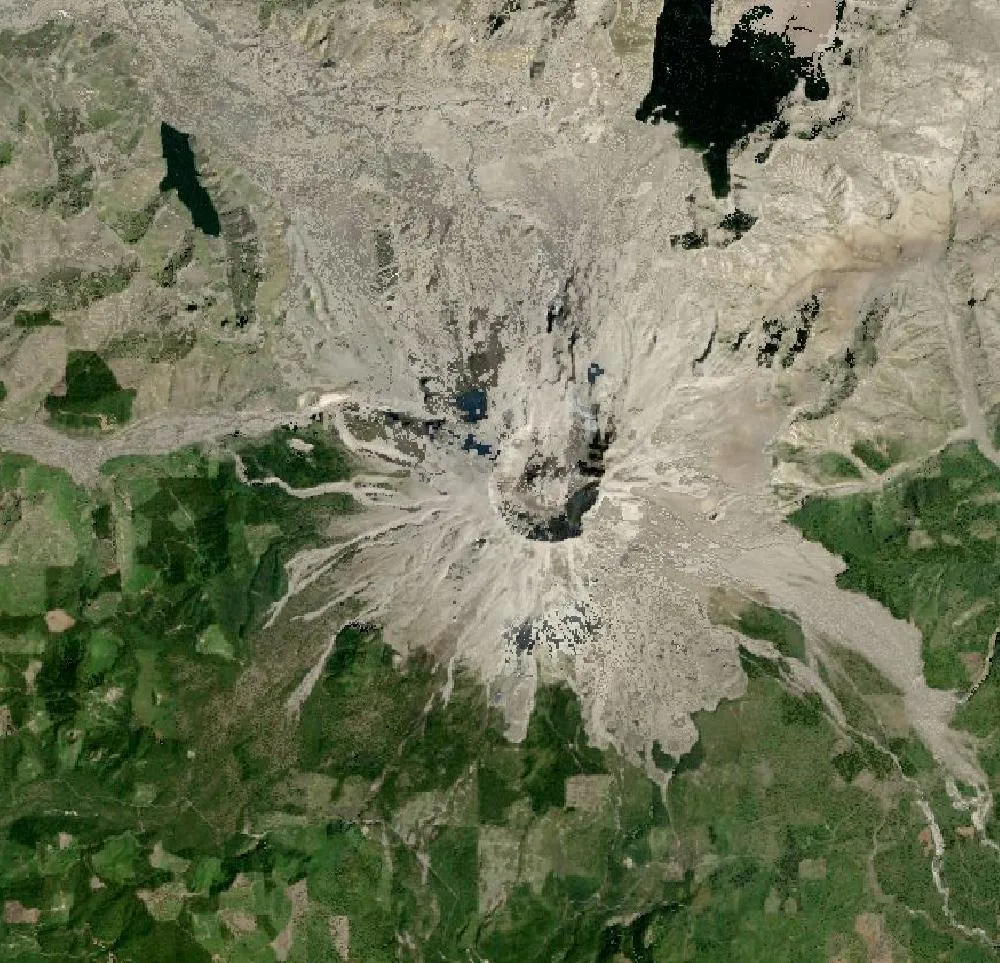
The left image is a 1985 Landsat composite, five years after the big eruption. The crater opens to the north, and the land around it is grey and bare, covered in ash and fallen trees. The right image is recent. Much of the grey area is now green with young forest, meadows and shrubs, although the crater and the slopes right below it are still bare rock.
The 1980 eruption
On 18 May 1980 an earthquake made the north side of the volcano slide away in the largest landslide ever recorded. This released a sideways blast that flattened forests over about 600 square kilometres. The top of the mountain was lowered by around 400 metres, leaving a horseshoe-shaped crater. Ash fell across several US states. Sadly, 57 people lost their lives, and the eruption led to much better volcano monitoring.
Life comes back
Scientists were surprised at how fast life returned. Some plants and small animals survived under snow or soil. Gophers dug up fresh soil, and prairie lupine, a purple flower that adds nutrients to the ground, spread across the ash. Elk returned to graze, and lakes recovered. In 1982 the area became the Mount St. Helens National Volcanic Monument, where much of the land was left to recover naturally so scientists could study it. Outside the monument, timber companies replanted millions of trees, which is why some areas look evenly green.
The volcano is still active
A lava dome grew in the crater in the 1980s and again from 2004 to 2008. A new glacier, Crater Glacier, has formed in the shade of the crater walls. The volcano is watched closely by the US Geological Survey.
How to read the images
Bare ash and rock look grey, forest looks dark green, meadows look light green, and lakes look dark blue. Spirit Lake, north of the crater, is still partly covered by floating logs from 1980.
For more years of change, explore Google Earth Timelapse (opens in a new tab), which shows Landsat images from 1984 to recent years for anywhere on Earth.
Frequently asked questions
When did Mount St. Helens erupt?
The major eruption happened on 18 May 1980. Smaller dome-building eruptions followed in the 1980s and from 2004 to 2008.
Has the forest recovered?
Much of it is green again with young forest, shrubs and meadows, but the land closest to the crater is still mostly bare.
Where do these images come from?
Both images are from NASA and USGS Earth-observing satellites (Landsat and the joint NASA HLS product). They are free public-domain data, and we host copies on our site.
More Earth then and now
Data and credits: Satellite images: NASA/USGS Landsat via NASA GIBS (Global Web-Enabled Landsat Data, 1985 annual composite) and NASA Harmonized Landsat Sentinel-2 (HLS), 2024-08-07, Sentinel-2 (HLS S30). Public domain (NASA/USGS); HLS Sentinel-2 data includes modified Copernicus Sentinel data, free and open. Imagery accessed through NASA Worldview/GIBS. Text written by ViralScopeHub from NASA Earth Observatory, USGS and other public sources. See all Live Earth & Space tools and our credits page.