What you are looking at
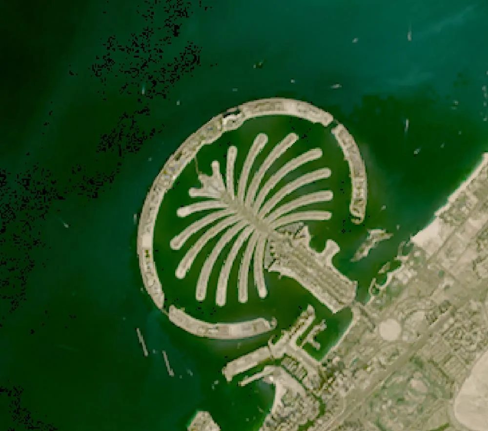
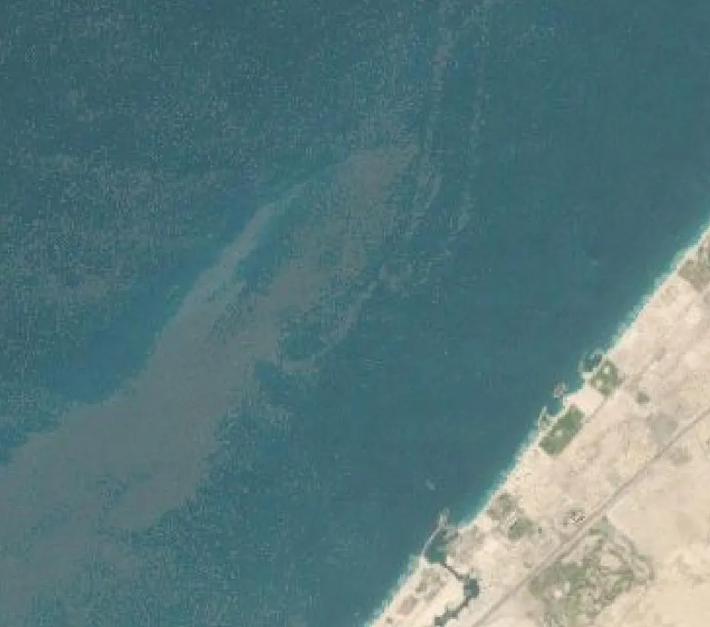
The left image is a Landsat composite from 2000. The coast of Jumeirah is a straight line of sand and the Gulf is open water. The right image is a recent satellite view of the same box. A trunk, 16 fronds and a curved breakwater now reach about 5 kilometres out to sea. It is one of the clearest human-made changes you can see from orbit.
How the island was built
Work started in 2001. Dredging ships sucked sand from the seabed of the Gulf and sprayed it into place in a method called “rainbowing”, guided by satellite positioning. Around 94 million cubic metres of sand and about 7 million tonnes of rock from local quarries went into the island. No concrete or steel was used to form the land itself. The rock went into the crescent, an 11-kilometre breakwater that protects the fronds from waves.
The first residents moved in around 2006 and 2007. The large hotel at the tip of the crescent opened in 2008. Today the island has homes, hotels, a monorail and beaches where there was once only water.
Why it looks the way it does
Dubai has a short natural coastline. A palm shape adds far more beachfront than a round island of the same size, so every frond gives homes a stretch of shore. The gaps in the crescent let water flow so the lagoons do not go stale, which was a problem engineers had to solve after the first design.
Effects on the sea
Building land in the sea changes currents, buries the old seabed and clouds the water with sediment for a while. Scientists have studied how waves and sand now move along Dubai’s coast and how corals and fish use the new rock walls. The breakwater rocks have become home to marine life, but the original sandy seabed under the island is gone.
How to read satellite colours
Shallow water over sand looks pale turquoise, deeper water looks dark blue, and built-up land looks grey or white. The two images come from different satellites and years, so colours are not exactly the same. Look at shapes, not shades.
For more years of change, explore Google Earth Timelapse (opens in a new tab), which shows Landsat images from 1984 to recent years for anywhere on Earth.
Frequently asked questions
When was Palm Jumeirah built?
Land reclamation began in 2001 and the island was mostly formed by 2006. Homes and hotels were added over the following years.
Can you see Palm Jumeirah from space?
Yes. It is about 5 km across, so it shows clearly in Landsat and Sentinel-2 images, and astronauts have photographed it from the International Space Station.
What is Palm Jumeirah made of?
Sand dredged from the seabed and rock from quarries. The rock forms the protective crescent breakwater.
Where do these images come from?
Both images are from NASA and USGS Earth-observing satellites (Landsat and the joint NASA HLS product). They are free public-domain data, and we host copies on our site.
More Earth then and now
Data and credits: Satellite images: NASA/USGS Landsat via NASA GIBS (Global Web-Enabled Landsat Data, 2000 annual composite) and NASA Harmonized Landsat Sentinel-2 (HLS), 2024-11-13, Landsat 8/9 (HLS L30). Public domain (NASA/USGS); HLS Sentinel-2 data includes modified Copernicus Sentinel data, free and open. Imagery accessed through NASA Worldview/GIBS. Text written by ViralScopeHub from NASA Earth Observatory, USGS and other public sources. See all Live Earth & Space tools and our credits page.