What you are looking at
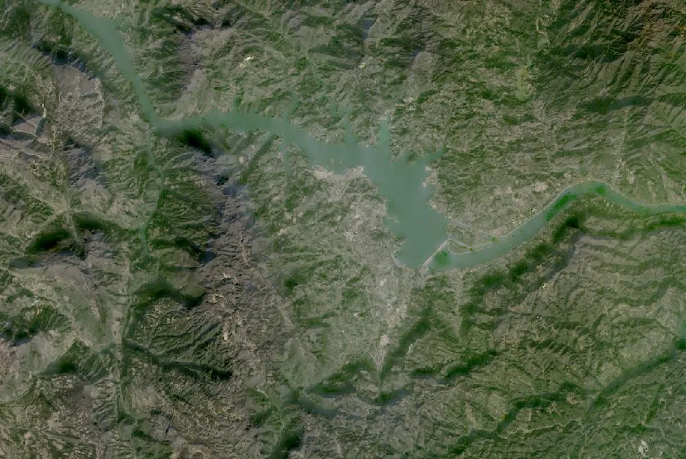
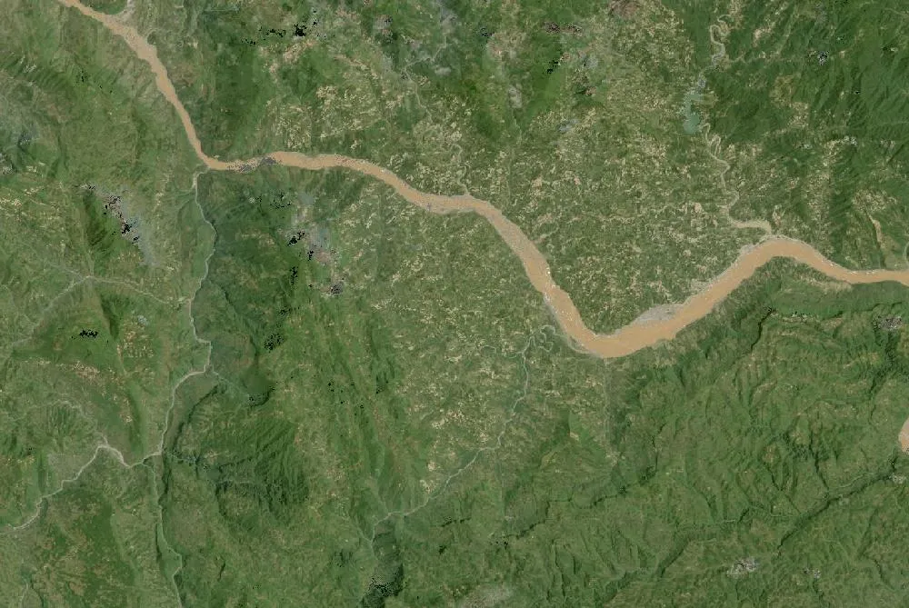
The images show the Yangtze River near the town of Sandouping in Hubei Province, China. In the 1990 Landsat composite the river is a narrow, winding ribbon through steep green mountains. In the recent image the river upstream of the dam is much wider, because it is now a long reservoir. You can see the straight line of the dam across the valley and the ship locks beside it.
The world’s largest power station
Construction of the Three Gorges Dam began in 1994. The main wall was completed in 2006 and the power station was fully working by 2012. The dam is about 2.3 kilometres long and 181 metres high. Its turbines can produce about 22,500 megawatts of electricity, more than any other power station on Earth.
Why it was built
The dam has three main jobs: making electricity without burning coal, controlling the floods that have hit the Yangtze for centuries, and making it easier for big ships to travel upstream. A five-step ship lock and a giant ship lift carry boats past the dam.
The cost of the reservoir
The reservoir stretches roughly 600 kilometres upstream. Rising water covered towns, farms and historic sites, and about 1.3 million people were moved to new homes. Scientists also study how the dam affects river fish, sediment reaching the coast, and landslides on the steep reservoir banks.
How to read the images
Forested mountains look dark green, the river and reservoir look blue-green or grey, and towns look grey. Winter images were chosen because there are fewer clouds over this often cloudy region.
For more years of change, explore Google Earth Timelapse (opens in a new tab), which shows Landsat images from 1984 to recent years for anywhere on Earth.
Frequently asked questions
When was the Three Gorges Dam built?
Construction started in 1994, the dam wall was finished in 2006 and full power generation began in 2012.
How big is the Three Gorges Dam?
About 2.3 km long and 181 m high, with a generating capacity of about 22,500 megawatts.
Where do these images come from?
Both images are from NASA and USGS Earth-observing satellites (Landsat and the joint NASA HLS product). They are free public-domain data, and we host copies on our site.
More Earth then and now
Data and credits: Satellite images: NASA/USGS Landsat via NASA GIBS (Global Web-Enabled Landsat Data, 1990 annual composite) and NASA Harmonized Landsat Sentinel-2 (HLS), 2025-12-05, Landsat 8/9 (HLS L30). Public domain (NASA/USGS); HLS Sentinel-2 data includes modified Copernicus Sentinel data, free and open. Imagery accessed through NASA Worldview/GIBS. Text written by ViralScopeHub from NASA Earth Observatory, USGS and other public sources. See all Live Earth & Space tools and our credits page.