What you are looking at
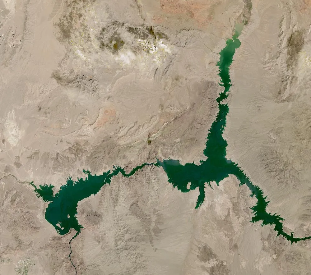
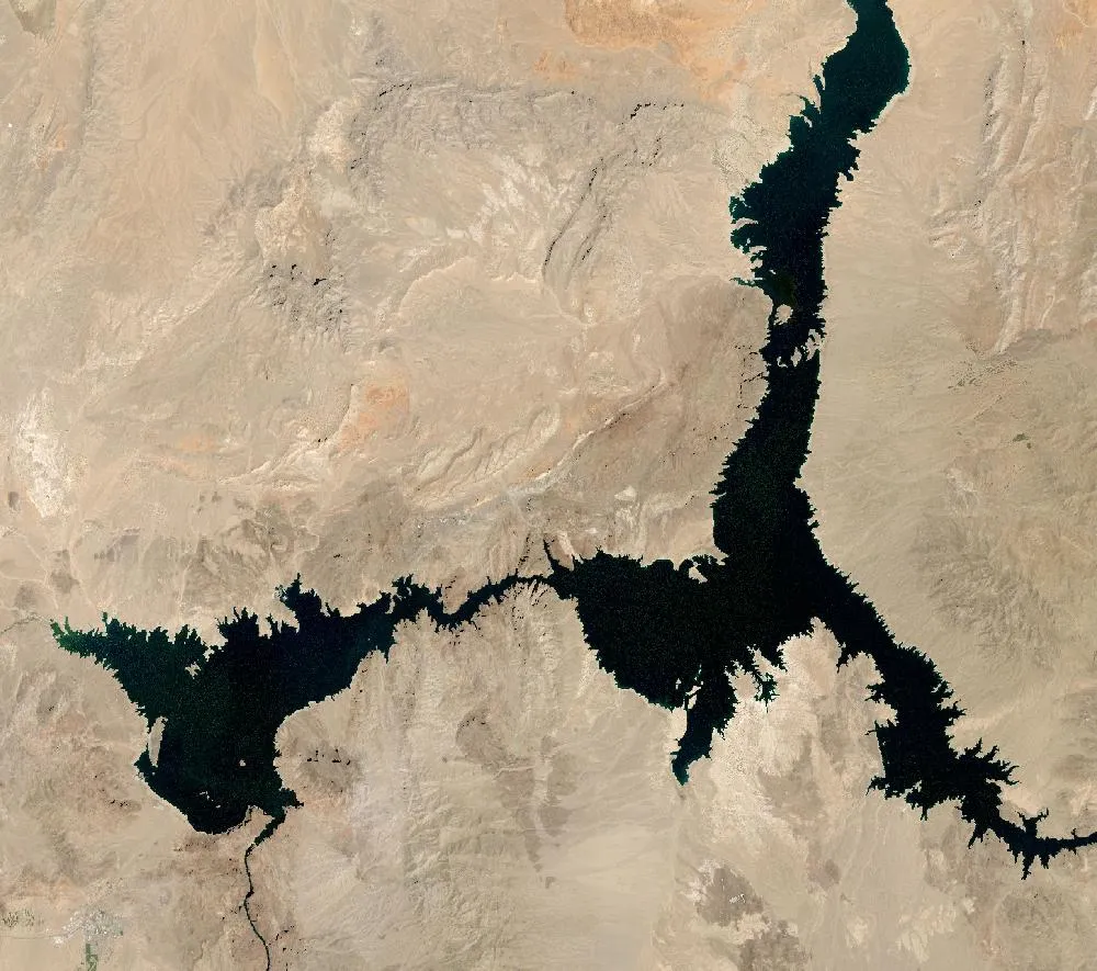
The left image is a 2000 Landsat composite, when Lake Mead was close to full. Dark blue water fills long arms reaching up the canyons. The right image is a recent view. The arms are thinner and shorter, and a pale “bathtub ring” of bare rock and old lake bed shows where water used to be.
America’s largest reservoir
Lake Mead formed behind Hoover Dam on the Colorado River after the dam was finished in the 1930s. By capacity it is the largest reservoir in the United States. It stores water for farms and cities in Nevada, Arizona, California and Mexico, including about 90% of the water for Las Vegas.
Why the level dropped
Since 2000 the Colorado River basin has faced a long drought, among the driest periods in more than 1,000 years according to tree-ring studies. Less snow in the Rocky Mountains meant less water flowing into the lake, while people kept taking water out. In July 2022 Lake Mead fell to its lowest level since it was first filled, about 1,040 feet above sea level, roughly a quarter full. Old boats and buildings that had been under water for decades appeared on the shore.
A partial recovery
A very snowy winter in 2022–23 and new water-saving deals between states helped the lake rise again by several feet. But scientists warn that the long-term trend is still downward because of warmer temperatures and high demand. States are negotiating new rules for sharing the river.
Saving water
Southern Nevada now recycles almost all indoor water back into the lake and has paid residents to remove thirsty grass. Farmers in other states have been paid to leave some fields unwatered. See our Las Vegas then and now page to see the city that depends on this water.
For more years of change, explore Google Earth Timelapse (opens in a new tab), which shows Landsat images from 1984 to recent years for anywhere on Earth.
Frequently asked questions
Why is Lake Mead so low?
A long drought in the Colorado River basin, warmer temperatures and high water use mean more water leaves the lake than flows in.
What was Lake Mead’s lowest level?
In July 2022 it reached about 1,040 feet above sea level, its lowest since the reservoir was first filled.
Where do these images come from?
Both images are from NASA and USGS Earth-observing satellites (Landsat and the joint NASA HLS product). They are free public-domain data, and we host copies on our site.
More Earth then and now
Data and credits: Satellite images: NASA/USGS Landsat via NASA GIBS (Global Web-Enabled Landsat Data, 2000 annual composite) and NASA Harmonized Landsat Sentinel-2 (HLS), 2025-09-05, Landsat 8/9 (HLS L30). Public domain (NASA/USGS); HLS Sentinel-2 data includes modified Copernicus Sentinel data, free and open. Imagery accessed through NASA Worldview/GIBS. Text written by ViralScopeHub from NASA Earth Observatory, USGS and other public sources. See all Live Earth & Space tools and our credits page.