What you are looking at
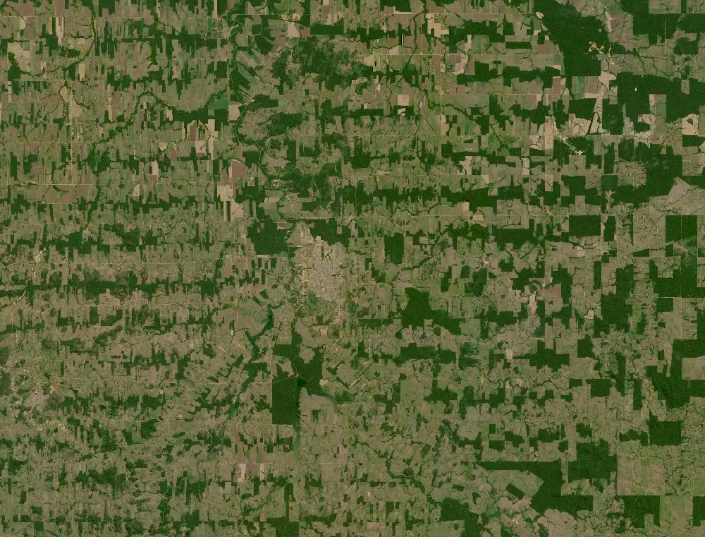
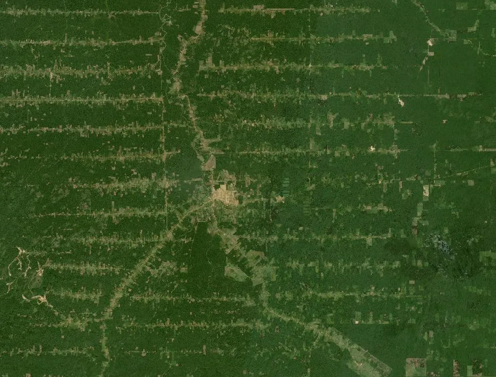
The left image is a 1985 Landsat composite of part of Rondônia, a state in western Brazil. Most of it is dark green, unbroken rainforest, crossed by a few roads with small cleared strips along them. The right image is recent. Large areas are now light green or tan fields, cut into neat rectangles, with only patches of dark forest left.
The “fishbone” pattern
In the 1970s and 1980s the government built a major highway, BR-364, through Rondônia and paved it in the 1980s. Settlers were offered land along new side roads that ran off the highway at right angles. Each family cleared forest from the road back into its plot. Seen from space, the main road and its side roads with cleared strips look like the bones of a fish. Over time the strips grew until they joined up.
Why forests are cleared
Most cleared land in the Amazon becomes cattle pasture. Some becomes crops such as soybeans. Logging roads and new towns also open up more forest. Rondônia became one of the most heavily deforested parts of the Brazilian Amazon.
Why it matters
The Amazon is the world’s largest rainforest. It holds a huge share of the planet’s plant and animal species, stores carbon in its trees, and makes much of its own rain by giving off water vapour. When large areas are cleared the land gets hotter and drier, wildlife loses its home and stored carbon goes into the air.
Watching from space
Brazil’s space agency, INPE, uses satellites to track forest loss every year, and alerts help officials find illegal clearing. Rates of deforestation have gone up and down over the decades with changes in laws and enforcement.
How to read the images
Healthy rainforest looks dark green and slightly bumpy. Pasture looks light green or yellow, bare soil looks pink or tan, and rivers look dark and winding.
For more years of change, explore Google Earth Timelapse (opens in a new tab), which shows Landsat images from 1984 to recent years for anywhere on Earth.
Frequently asked questions
What is the fishbone pattern?
A pattern of deforestation where side roads run off a main highway and farms clear forest along each road, so from above it looks like a fish skeleton.
Why is the Amazon cleared?
Mostly for cattle pasture, and also for crops, logging and new settlements.
Where do these images come from?
Both images are from NASA and USGS Earth-observing satellites (Landsat and the joint NASA HLS product). They are free public-domain data, and we host copies on our site.
More Earth then and now
Data and credits: Satellite images: NASA/USGS Landsat via NASA GIBS (Global Web-Enabled Landsat Data, 1985 annual composite) and NASA Harmonized Landsat Sentinel-2 (HLS), 2024-06-13, Sentinel-2 (HLS S30). Public domain (NASA/USGS); HLS Sentinel-2 data includes modified Copernicus Sentinel data, free and open. Imagery accessed through NASA Worldview/GIBS. Text written by ViralScopeHub from NASA Earth Observatory, USGS and other public sources. See all Live Earth & Space tools and our credits page.