What you are looking at
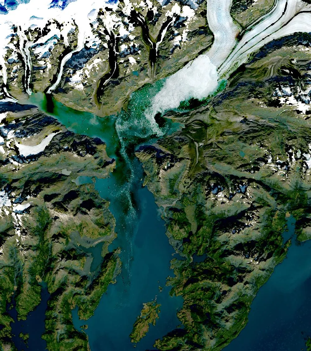
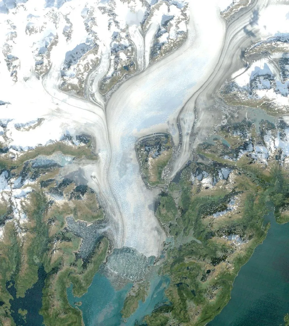
The left image is a 1985 Landsat composite. The Columbia Glacier fills its fjord as a wide river of white and blue ice that reaches down to the sea in Prince William Sound. The right image is recent. The ice front has moved far back up the valley and open water, dark blue, now fills much of the fjord that was ice before. The glacier has also split into separate branches.
A tidewater glacier
Columbia is a tidewater glacier, which means it ends in the sea. Big blocks of ice break off its front and fall into the water, called calving. For centuries its front rested on a shallow ridge of rock and gravel near Heather Island, which held it steady.
Around 1980 the front pulled back off that ridge into deeper water. Deeper water lets more ice break off, so calving sped up, and the glacier began a rapid retreat. Since then it has retreated more than 20 kilometres and become much thinner, making it one of the fastest-changing glaciers in the world.
Is it climate change?
Scientists say warming temperatures thinned the glacier and helped start the retreat, and then the deep fjord made it run away much faster. Many land-based glaciers around the world are also shrinking because of warmer temperatures, but tidewater glaciers like Columbia can change especially quickly. The retreat may slow when the front reaches shallower ground.
New land, new life
As the ice pulls back, a new fjord opens up. Seals, birds and fish move into the new water, and plants slowly start to grow on the bare rock left behind.
How to read the images
Glacier ice looks white or pale blue, snow is bright white, open sea looks dark blue and bare rock looks grey or brown. Floating icebergs show up as white specks in front of the glacier.
For more years of change, explore Google Earth Timelapse (opens in a new tab), which shows Landsat images from 1984 to recent years for anywhere on Earth.
Frequently asked questions
How far has Columbia Glacier retreated?
More than 20 kilometres since the early 1980s, which makes it one of the fastest-retreating glaciers on Earth.
What is a tidewater glacier?
A glacier that flows all the way to the sea and loses ice by calving, where blocks of ice break off into the water.
Where do these images come from?
Both images are from NASA and USGS Earth-observing satellites (Landsat and the joint NASA HLS product). They are free public-domain data, and we host copies on our site.
More Earth then and now
Data and credits: Satellite images: NASA/USGS Landsat via NASA GIBS (Global Web-Enabled Landsat Data, 1985 annual composite) and NASA Harmonized Landsat Sentinel-2 (HLS), 2025-09-17, Landsat 8/9 (HLS L30). Public domain (NASA/USGS); HLS Sentinel-2 data includes modified Copernicus Sentinel data, free and open. Imagery accessed through NASA Worldview/GIBS. Text written by ViralScopeHub from NASA Earth Observatory, USGS and other public sources. See all Live Earth & Space tools and our credits page.